Trail Walking Villnöß - Funes - Sentiero del sole-sentiero panoramico - Photo

Sentiero del sole-sentiero panoramico

 Bruno566
Bruno566

User

© OpenStreetMap contributors
Length
Length
6.6 km
Max alt
Max alt
1416 m
Uphill gradient
Uphill gradient
308 m
Km-Effort
Km-Effort  
10.7 km
Min alt
Min alt
1136 m
Downhill gradient
Downhill gradient
308 m
Boucle
Boucle
Yes
Creation date :
2024-12-26 20:59:27.564
Updated on :
2025-05-30 09:23:21.9

(0 Reviews)

Walking
Walking
2h25
Difficulty : Medium

Scan this QR Code to open this trail in the SityTrail application

FREE GPS app for hiking

Logo SityTrail SityTrail

IGN / Geographical institutes

Download SityTrail from the App Store Download SityTrail from Google Play

Logo SityTrail SityTrail Plus

The world is yours!

Download SityTrail from the App Store Download SityTrail from Google Play Download SityTrail on Huawei AppGallery

About

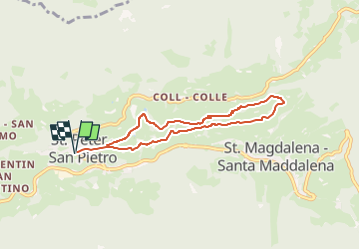
Trail Walking of 6.6 km to be discovered at Trentino-Alto Adige/Südtirol, South Tyrol, Villnöß - Funes. This trail is proposed by Bruno566.

Elevation profile

Points of interest

Point of interest Villnöß - Funes - Parcheggio S. Pietro - Photo
Bruno566
VILLNÖSS - FUNES 
Point of interest Villnöß - Funes - Halsl Hütte - Photo
Bruno566
VILLNÖSS - FUNES 
Point of interest Villnöß - Funes - Biblioteca S. Pietro - Photo
Bruno566
VILLNÖSS - FUNES 
Point of interest Villnöß - Funes - Pilone della peste al sentiero del sole - Photo
Bruno566
Point of interest Villnöß - Funes - Chiesa parrocchiale di S. Pietro e Paolo (1801) - Photo
Bruno566
Point of interest Villnöß - Funes - Cappella S. Michele di Pizzago - Photo
Bruno566
Point of interest Villnöß - Funes - Chiesa parrocchiale di S. Pietro e Paolo (1801) - Photo
Bruno566
Point of interest Villnöß - Funes - Cappella S. Michele di Pizzago - Photo
Bruno566

Positioning

Country:
Italy
Region :
Trentino-Alto Adige/Südtirol
Department/Province :
South Tyrol
Municipality :
Villnöß - Funes
Location:
Unknown
Start:(UTM)
705115 ; 5168896 (32T) N.


Close
My subscriptions